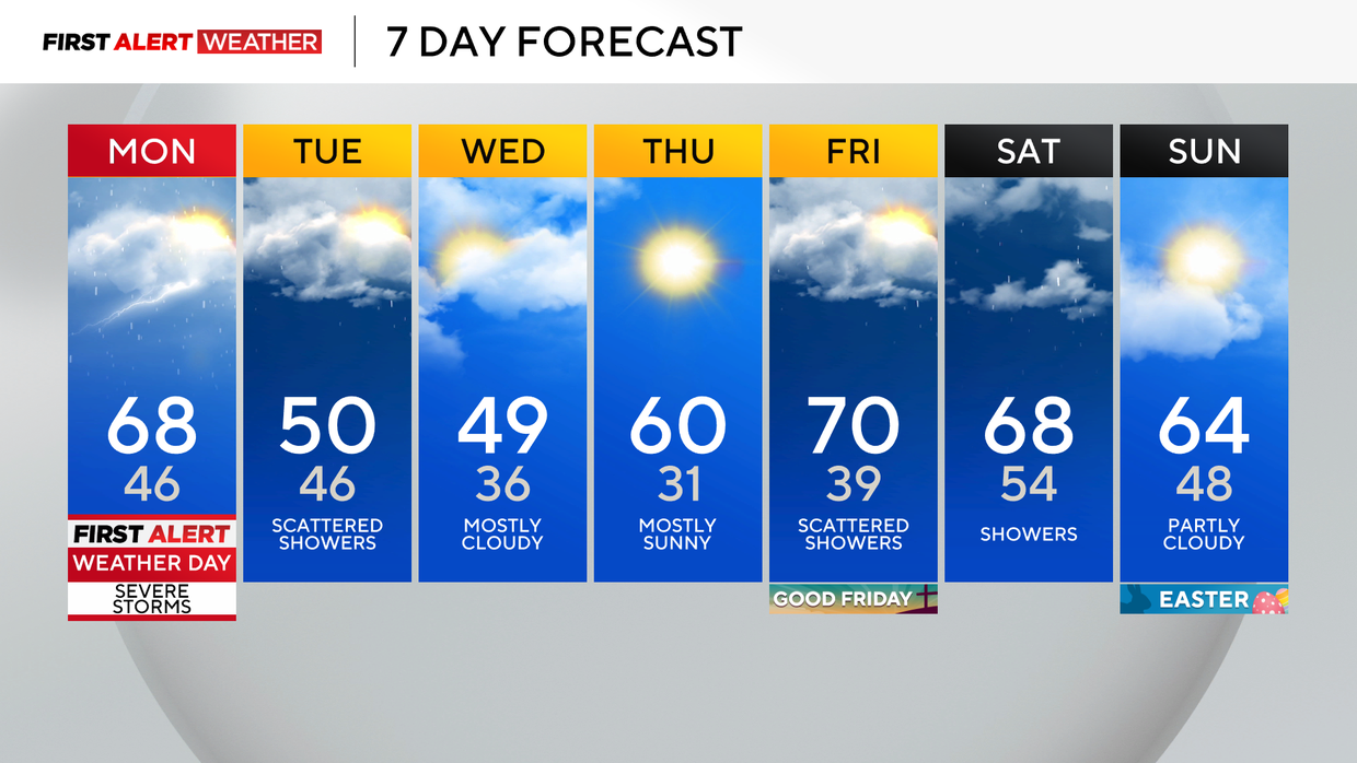
Colder and windy Tuesday and Wednesday throughout Pittsburgh area with snow showers north of I-80
Finally, some sunshine to end our weekend, with temperatures near or just above normal in the 60s!
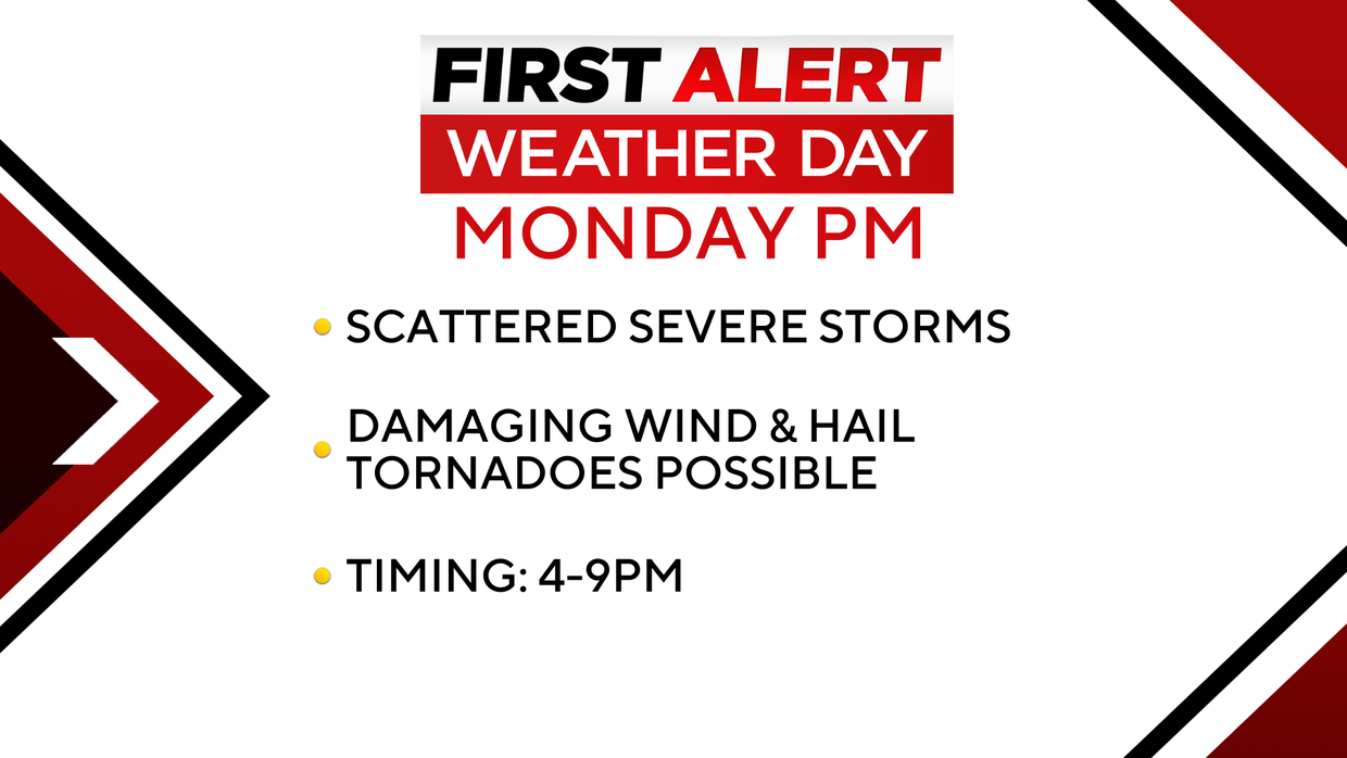
First Alert: Monday p.m./evening (Scattered severe storms)
Climate: Average High: 62 | Average Low: 40
Skies will cloud up overnight with a few showers sneaking in after midnight through early morning, amounting to only a bit of drizzle in many spots. Monday will remain warm with highs in the upper 60s before a strong cold front arrives late afternoon and evening, touching off a line of showers and potentially severe storms.
Monday is a First Alert Weather Day for the risk of severe storms later in the afternoon and early evening.
The Storm Prediction Center in Norman, Oklahoma, has placed the southern half of our area south of Pittsburgh in a level 2 out of 5 "Slight Risk" for severe storms. Storms are expected to move across western Pennsylvania between 4-9 p.m., then exit our southeast counties by 11 p.m.
The greatest concern for severe weather will likely be south of I-70, as this is where the greatest combination of moisture and unstable air will be co-located. Isolated instances of large hail will be possible along with damaging wind gusts of 60 mph.
The tornado threat remains low, but is most likely south of I-70 and into northern W. Va.
Following the cold front, Tuesday will be much colder and windy, with highs barely reaching 50 degrees. We'll see a few gusty showers and could even see wet snowflakes and some graupel mix in (especially north of I-80 and into the Laurel Highlands).
Wednesday remains chilly before another warming trend on Thursday and a few showers for Good Friday.
WEATHER LINKS:
Current Conditions | School Closings & Delays | Submit Your Weather Photos


